
The city and its environs - paths of socio-ecological transformation, needs for action and governance structures in the urban-environs context
Research question & used methods:
The socioeconomic contrasts as well as urban planning and planning aspects of the Distrito Federal have been investigated and
analyzed in numerous studies. In contrast, the large-scale development of the metropolitan region has been little
researched. This is the point that this contribution aims to address, with the research question:
How does Brasília, in its capacity as capital city, manage inter-municipal cooperation and the spatial
development of the metropolis?
In order to better understand the role of the Federal District and its current challenges, it is important to take
a closer look at the administrative structures.
• What collaborations exist between the Federal District and the surrounding municipalities?
• How can the Brasília metropolitan region be spatially delineated?
In order to find this out, primarily existing literature was evaluated and open content aspects on site were
covered with expert interviews. Furthermore, on a smaller scale, local observations and walk-throughs were
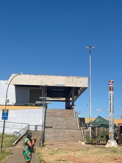
conducted in the administrative regions of Ceilândia and Samambaia. Due to the complexity of the topic and the
short development history of Brasília, the literature research was limited by the small literature spectrum.
The special character of the Districto Federal:
Meaning of Districto Federal: Due to its hybrid character as an administrative body, the Distrito Federal contains competences to act at the federal level and at the state level. It is divided into 31 Regiões administrativas, including the central administrative zone of Plano Piloto. In addition, the Distrito Federal has a special status under the Constitution (1988) in that it is prohibited from governing autonomous municipalities. The active decision-maker is the Governor of the Distrito Federal and his representatives. Since the Distrito Federal includes state and municipal powers, they cannot be separated, which makes the aforementioned administrative regions dependent on the governor of the Distrito Federal. The surrounding states, on the other hand, have a state constitution with autonomous municipalities.
Governance structures and areas of action:
NOVACAP (Companhia Urbanizadora da Nova Capital do Brasil) (1956): State-created authority that had a
headquarters in a city that did not yet exist in the beginning. Main actor for all development processes in the
spatial production (landowner) of the Distrito Federal and single decision maker for all administrative
matters
possesses bureaucratic self-government right in the urbanization process. NOVACAP was considered the sole owner of
almost all the land in the new Distrito Federal until 1964. Consequently, the institution retained any right to
act as an independent decision-maker. With bureaucratic authority, NOVACAP was able to decide how the capital city
would continuously expand in its development. This includes, among other things, the course of development of
future business locations or industrial sites. The role as the main actor in the state's interest to control the
development process in the socioeconomic context show the result of incidents of abuse of authority in the sense
of corruption allegations within the area of responsibility from land acquisition and land allocation. One of the
central tasks in the newly formed Distrito Federal was to communalize the land market by buying up the entire land
area. The intended nationalization of land ownership by the Federal Government in order to be able to carry out
unimpeded implementation of planning administration has not been settled to date. The unresolved ownership issues
highlight the current different types of land ownership in the state, such as private ownership or expropriated
land. They pose a problem not only for the administrative structure, but also for settlement development (Bose
2017).
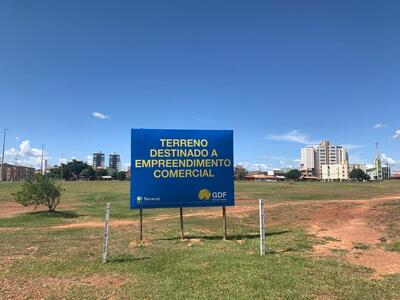
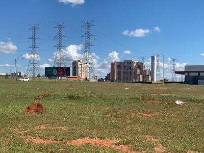
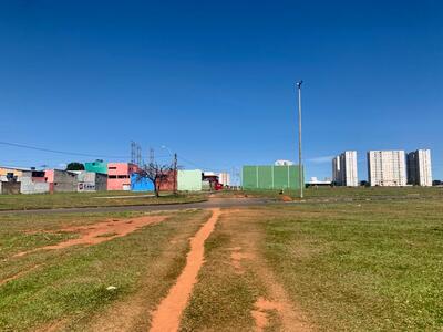
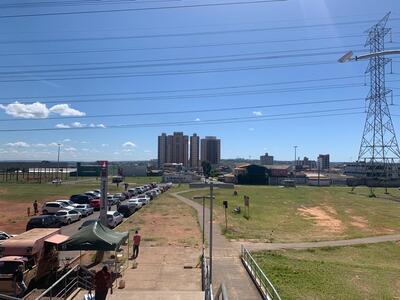
TERRACAP (Companhia Imobiliária de Brasília) (1973): Authority that manages the land area in the Distrito Federal as a
public decision maker and administrator, acting in the interest of the capital administration (1960) Governo do
Distrito Federal. The fields of action include the areas such as building permits for space production and
concession granting (Fig. 1-6) (Terracap 2022).
SUDECO (Superintendencia do Desenvolvimento do Centro – Oeste) (1967): Is a regulatory agency that
monitors the development trajectory of the Midwest. The goal is to drive sustainable socioeconomic transformation
with Midwest State Constitutional Funds (FCO).
What happened in the region?
The Distrito Federal has the highest growth of population in Brazil and a strongly increasing wealth. It is now the 3rd
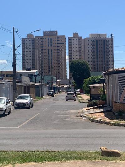
largest metropolitan area in the country. The surrounding municipalities of the Distrito Federal form a belt of
underdevelopment. This periphery grew with all those who cannot afford to live in the Plano Piloto. This is
easily seen in the distribution of average income and completed college degrees in the region. Most of the
residents of the surrounding municipalities work in the Distrito Federal, or the jobs in the municipalities depend on the
officials of the capital who live there (Sasse 2020).
The emerging problems due to the increase in people are only solvable through public policies, job creation and
infrastructure development. But until now, no way has been found to integrate these municipalities around the Distrito Federal
and create a metropolitan region. In fact, there is an institutional mess, there has been research, debates,
political negotiations and projects for legal support and integration of the region, but little has been done in
practice. Integration of the periphery needs a functioning institutional arrangement, and it needs agreement on
the actual size of the Distrito Federal's sphere of influence. To create an integrated region, there have been different
approaches to delineate the region and, in addition, attempts to create a legal legitimacy/foundation for the
region (Paviani 2019).
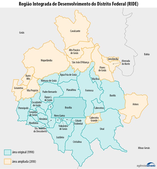
Experiments for an integrated region
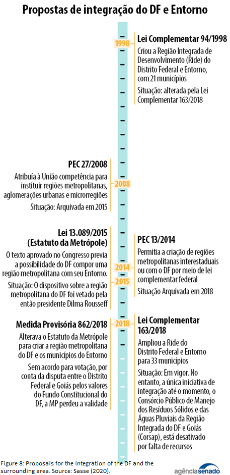
1998:Região Integrada do Districto Federal e Entorno (RIDE) (fig. 7) was
created,
it initially consisted of 21 municipalities and was expanded to 33 in 2018. The intention was to build a
socio-economic relationship between the neighboring states of the Entorno and the Federal
District. RIDE is a
governing board for the development of the area surrounding the Federal District. However, the gigantism of
RIDE, do not make its operation easy. RIDE's successes have been rather minimal, and many projects have been
reinstated or have never been implemented (fig. 8) (Distrito Federal 2014).
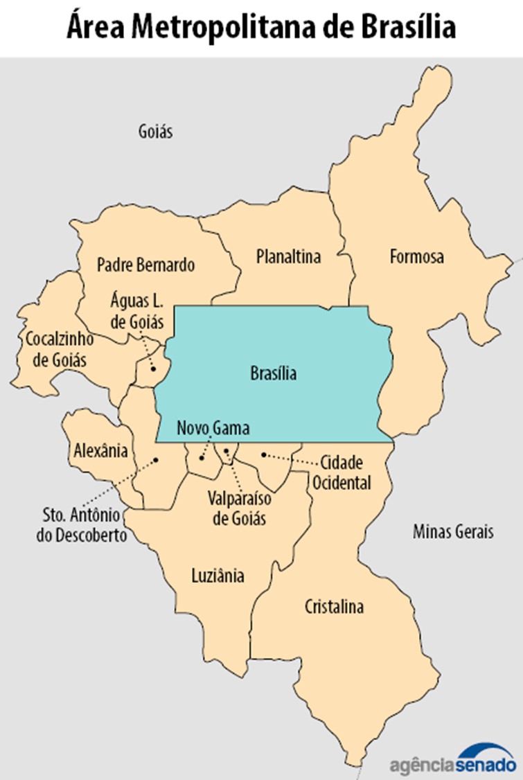
2014: In the Codeplan, the Área Metropolitana (AMB) (fig. 9) was planned, this consists of 12 neighboring municipalities in Goiás. The metropolitan area serves as a template for the construction of an interconnection network that should enable the progress of socio-economic transformation within the periphery. It is hoped to foster regional cooperation and promote stagnant regional development. However, the members of the AMB do not recognize the existence of RIDE and no public policy is established (Paviani 2019).
2015: Metropolis Statute Law 13.089 for the creation of a metropolitan region, for which it requires
federal authorization and public policy based on state laws and district law. Then-President Dilma Rousseff
vetoes the law.
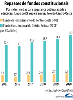
2018: Provisional Measure (MP) 862/2018 to amend the Metropolitan Statute to create the Distrito Federal Metropolitan
Region and surrounding municipalities. However, the MP must comply with the 1988 Constitution and the dispute
over government funding the Fundo Constitutional do Distrito Federal (FCDF) and the Fundo de
Financiamento do
Centro-Oeste (FCO) blocked the MP (fig. 10). As a result, the MP lost validity
and there are no new projects
(Sasse 2020).
What happened in regional development?
Cooperation:
Intermunicipal cooperation does not exist in an official way, because coordination
between neighboring municipalities is difficult, even coordination within the Distrito Federal works in a limited way.
Accordingly, the top-down problem emerges. As a result of the fact that official forms of regulation do not
work, special-purpose associations are formed out of necessity to cooperate on a sectoral and topic-specific
basis. Especially in the waste management and health sector (Carvalho de Souza 2022 & Pires 2022).
Finances:
The federal district receives tax funds for self-government of the region. The available
financial resources should be transferred to neighboring municipalities in the interest of regional development.
However, the money remains in Brasília, which is used for non-priority projects (fig. 11). The inconsistencies
in the regulation of financial resources lead to contrasts and social fragmentation within the region (Carvalho
de Souza 2022).
Economic Pivot:
To strengthen the region as an economic unit, as is found between São
Paulo
and Rio de Janeiro, this is sparsely promoted in the Distrito Federal between its neighboring states. The
only
economic axis Eixo has existed between Anápolis-Goiânia since the founding of Brasília
(fig. 12).
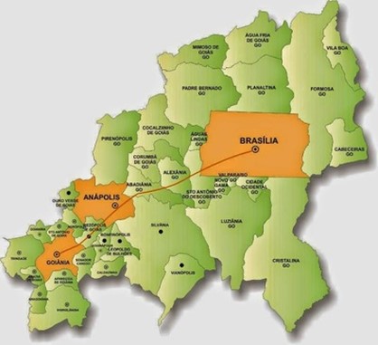
The spatial construct, with Brasília as the functional center towards the west to Goiânia, is a
particular
model. The association of a cooperative collaboration reflects the creation of an industrial interdependence
space. With existing spatial resources (e.g. agricultural land) in the nearby hinterland, the region developed
into a dynamic economic sector, especially in the agricultural industry as a grain producer (e.g. soy, corn) or
in the pharmaceutical and automotive industries. Due to the increasing importance as an economic axis, the
spatial structure evolved, influencing the integration of interlaying cities, such as Anápolis in their
valorization and importance. The city of Anápolis thus developed into a polycentric center, which, as the
logistical center of the Central - West region, represents a central role for future infrastructural
interdependencies and developments. It should be emphasized that such interconnectedness promotes the
socioeconomic transformation path inside and outside the Distrito Federal. Due to the low level of
political
interest, Brasília is discarding the opportunity to act as an economic hub for the central West. The possibility
to expand the stagnant development would be to promote Anápolis as a new hub due to its favorable
position to
its neighboring states (Pires 2022).
Conclusion
At the moment Brasília hardly controls inter-municipal cooperation and spatial development of the metropolitan region, since all projects and schemes are not implemented or fail. Therefore, Sudeco, as the superintendence for the development of the Midwest, should be strengthened so that resources are targeted. Sudeco, Goiás and Distrito Federal have not been able to work out a joint solution to date. Nevertheless, there is a need to work together to find solutions so that political rivalries are resolved. According to the Experts these are the main factors the region is progressing so slowly in its development and being abandoned by many action representatives. Consortia are needed to manage the region (waste, health, etc.). The amendment of the Constitution (PEC) allows delimiting micro-regions around cities with more than one million inhabitants. The goal is to integrate the organization, planning and execution of public tasks of common interest. Funds would be used exclusively to finance infrastructure investments and costs in the metropolitan region (Sasse 2020, Paviani 2019, Carvalho de Souza 2022 & Pires 2022).
Further figures and pictures
Click here to go back to the text section about RIDE
Click here to go back to the text section about AMB
Click here to go back to the text section about FCO and FCDF
All illustrations, graphics, tables and photos used in connection with the topic Governance as
well
as the present text were
created or taken by Max Covino and Mery Pocrnja if not stated differently.
References
CARVALHO DE SOUZA, Sergio Magno. Reflexões sobre Brasília e sua(s) região(ões): política regional e política metropolitana In: Território e sociedade: As múltiplas faces da Brasília metropolitana [en ligne]. Marseille: IRD Éditions, 2019. S. 109-120. Abrufbar unter: https://books.openedition.org/irdeditions/35809
Deckkert T. (2015): Brasília. Life Beyond Utopia. Architectural Design 86 (3), S.88-95.
HOLANDA F. DE, MADEIROS V., RIBEIRO R. & MOURA A. (2015): Brasília: Fragmented metropolis. SSS10 Proceedings of the 10th International Space Syntax Symposium. 051, S. 1-20.
Kaiser W. (1987): Städtische Entwicklung und räumlich-soziale Segregation im Bundesdistrikt von Brasília (Distrito Federal). Tübinger Geographische Studien, H.93, S.175-197. Moura R. u. M. Haddad (2016): Dinâmicas de expansão do arranjo urbano-regional Brasília-Anápolis- Goiânia. Abrufbar unter: https://www.researchgate.net/publication/305876664_Dinamicas_de_expan- sao_do_arranjo_urbano-regional_Brasilia-Anapolis-Goiania/fulltext/588b9b49a6fdcc8e63c8051c/Dinamicas-de-expansao-do-arranjo-urbano-regional-Brasi- lia-Anapolis-Goiania.pdf?origin=publication_detail.
PAVIANI, Aldo. Área metropolitana de Brasília a integrar: o desafio do desemprego e da descentralização de atividades In: Território e sociedade: As múltiplas faces da Brasília metropolitana. Marseille: IRD Éditions, 2019, S. 47-58. Abrufbar unter: https://books.openedition.org/irdeditions/35764
Websites:
TERRACAP (2022): Aeroporto Executivo de Brasilia tera nova administracao em 2022. Abrufbar unter: https://www.terracap.df.gov.br/index.php (letzter Abruf 02.01.2022).
NOVACAP (2021): Companhia Urbanizadora da Nova Capital do Brasil. Abrufbar unter: http://www.novacap.df.gov.br/ (letzter Abruf 20.12.2021).
Senado Federal, Sasse C. (2020): Brasília é cercada por cinturão de pobreza, apesar de dinamismo econômico da região Fonte: Agência Senado. Abrufbar unter: https://www12.senado.leg.br/noticias/infomaterias/2020/05/brasilia-e-cercada-por-cinturao-de-pobreza-apesar-de-dinamismo-economico-da-regiao (letzter Abruf 27.10.2022)
Interviews:
Sergio Magno Carvalho de Souza 2022: Professor do Ensino Básico, Técnico e Tecnológico - Área: Geografia
Mauro Pires 2022